PIN (Postal Index Number) Code of India on Indian Map | First Digit of PIN shows Regions and First Two Digits Represents Circles Names
The Postal Index Number (PINCODE) is an important part of any address in India. But why is that important and how does it help the postal department? Here is making sense of the 6 digit PINCODE. What does the PINCODE (Postal Index Number) mean? Why do the Postal Department & Courier firms ask you to write the PINCODE of the addressee? Why is it so important? Postal Index Number (PIN) or PIN Code is a 6 digit code of Post Office numbering used by India Post.
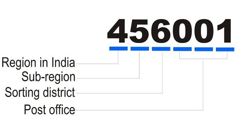
The PIN was introduced on August 15, 1972. There are 9 PIN regions in the country. The first 8 are geographical regions and the digit 9 is reserved for the Army Postal Service. The first digit indicates one of the regions. The second digit indicates the sub region or one of the postal circles (States). The third digit indicates a sorting / revenue district. The last 3 digits refer to the delivery Post Office.
First Digit of PIN Indicates as
If the PINCODE is 577401, then 5 indicates Southern region & 57 indicates KARNATAKA. 577 indicates the district of Shivamogga and the last 3 digits (401) indicate the Sagar Head Post office in this area. That is how the postal department sorts the incoming mails and routes them to the correct post office.


No comments